Destinations › Andes & Galápagos › Quito
Quito
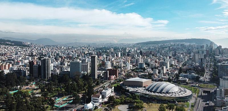
Photo: Asamblea Nacional del Ecuador · CC BY-SA 2.0

CountryEcuador
RegionAndes & Galápagos
Best monthsJul–Aug
Nearest airportsUIO · Mariscal Sucre International Airport · 20 km
LTX · Cotopaxi International Airport · 77 km
TUA · Lieutenant Colonel Luis A. Mantilla International Airport · 145 km
LTX · Cotopaxi International Airport · 77 km
TUA · Lieutenant Colonel Luis A. Mantilla International Airport · 145 km
About
Quito, officially San Francisco de Quito, is the capital and second-largest city of Ecuador, with an estimated population of 1.7 million in the city and 2.8 million in its metropolitan area. It is also the capital of the province of Pichincha.
Source: Wikipedia (CC BY-SA 4.0)
When to go
In Quito the warmest month is August (average high 22°) and the coolest is November (20°). Most rainy days come in April. Best months to visit: Jul–Aug.
Highlights
From OpenStreetMap records, by distance from the centre.
- Plaza de la IndependenciaNature & park · 27 m
- Catedral Metropolitana QuitoSight · 43 m
- La Iglesia de El SagrarioSight · 68 m
- Museo Alberto Mena CaamañoMuseum · 80 m
- Museo de la CatedralMuseum · 85 m
- Iglesia Católica de la Inmaculada ConcepciónSight · 101 m
- Parque Iglesia InmaculadaNature & park · 151 m
- Iglesia de la Compañia de JesusSight · 178 m
- Casa de Diego de Sandoval CadisanSight · 179 m
- Museo NumismáticoMuseum · 208 m
- Teatro BolívarSight · 209 m
- San AgustínSight · 211 m
For families with children
Parks, beaches and child-friendly places.
- Plaza de la IndependenciaNature & park · 27 m
- Parque Iglesia InmaculadaNature & park · 151 m
- Plaza Huerto San AgustínNature & park · 280 m
- Plaza del TeatroNature & park · 438 m
- semaforoNature & park · 648 m
- Plaza San MarcosNature & park · 681 m
- Parque García MorenoNature & park · 798 m
- Plaza San BlasNature & park · 838 m
Average monthly temperature (°C)
| Jan | Feb | Mar | Apr | May | Jun | Jul | Aug | Sep | Oct | Nov | Dec | |
|---|---|---|---|---|---|---|---|---|---|---|---|---|
| High | 20 | 20 | 20 | 20 | 20 | 21 | 21 | 22 | 21 | 21 | 20 | 20 |
| Low | 9 | 9 | 9 | 9 | 9 | 8 | 8 | 8 | 8 | 9 | 8 | 9 |
| Rainy days | 14 | 16 | 18 | 20 | 18 | 8 | 5 | 6 | 11 | 17 | 16 | 15 |
Climate data: Wikipedia (CC BY-SA)