Destinations › Andes & Galápagos › Aguas Calientes
Aguas Calientes
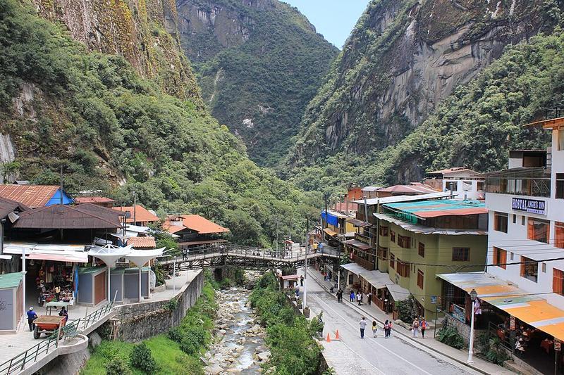
Photo: Laslovarga · CC BY-SA 4.0
.jpg)
CountryPeru
RegionAndes & Galápagos
Best monthsNo clear best season
Nearest airportsCUZ · Alejandro Velasco Astete International Airport · 76 km
About
Machupicchu or Machupicchu Pueblo, also known as Aguas Calientes, is a location in Peru situated in the Cusco Region, Urubamba Province. It is the seat of Machupicchu District.
Source: Wikipedia (CC BY-SA 4.0)
When to go
In Aguas Calientes the warmest month is September (average high 23°) and the coolest is January (21°).
Highlights
From OpenStreetMap records, by distance from the centre.
- Virgen del CarmenSight · 60 m
- Plaza Del AmautaNature & park · 315 m
- Access to the Phutuq K’usi CLOSED - Access on the other side of the mountainSight · 385 m
- Baños TermalesSight · 608 m
- Access to the Phutuq K’usiSight · 1.2 km
- Puente ruinas control peatonal ABRE 5AM-2PMSight · 1.5 km
- MandorNature & park · 1.9 km
For families with children
Parks, beaches and child-friendly places.
Average monthly temperature (°C)
| Jan | Feb | Mar | Apr | May | Jun | Jul | Aug | Sep | Oct | Nov | Dec | |
|---|---|---|---|---|---|---|---|---|---|---|---|---|
| High | 21 | 21 | 21 | 22 | 22 | 22 | 22 | 23 | 23 | 23 | 23 | 21 |
| Low | 12 | 12 | 12 | 12 | 11 | 10 | 9 | 10 | 11 | 12 | 12 | 12 |
Climate data: Wikipedia (CC BY-SA)