Destinations › Patagonia & Atacama › Bariloche
Bariloche
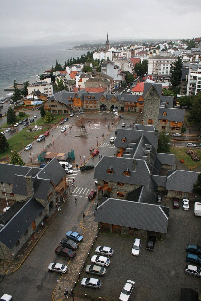
Photo: Carlos Ravazzani · CC BY-SA 3.0

CountryArgentina
RegionPatagonia & Atacama
Best monthsJan–Feb
Nearest airportsBRC · San Carlos de Bariloche Airport · 12 km
CPC · Aviador Carlos Campos Airport · 120 km
CPC · Aviador Carlos Campos Airport · 120 km
About
San Carlos de Bariloche, commonly known simply as Bariloche, is the largest city in the Argentine province of Río Negro and the seat of the department of the same name. It is located in the foothills of the Patagonian Andes on the southern shore of Nahuel Huapi Lake, near the border with Chile.
Source: Wikipedia (CC BY-SA 4.0)
When to go
In Bariloche the warmest month is January (average high 23°) and the coolest is July (7°). Most rainy days come in June. Best months to visit: Jan–Feb.
Highlights
From OpenStreetMap records, by distance from the centre.
- Plazoleta Juan Bautista y Federico ChiguayNature & park · 378 m
- Plaza de los Trabajadores "Jacinto Jiménez"Nature & park · 449 m
- Plaza Mayor del CentenarioNature & park · 459 m
- Plazoleta Sara María FurmanNature & park · 486 m
- Parroquia Medalla MilagrosaSight · 505 m
- Plaza San MartínNature & park · 623 m
- Plaza Omar RodríguezNature & park · 695 m
- Parroquia Santo CristoSight · 702 m
- Capilla La Sagrada FamiliaSight · 839 m
- Plaza de la CooperaciónNature & park · 1.0 km
- María AuxiliadoraSight · 1.1 km
- Parroquia Del CarmenSight · 1.2 km
For families with children
Parks, beaches and child-friendly places.
- Plazoleta Juan Bautista y Federico ChiguayNature & park · 378 m
- Plaza de los Trabajadores "Jacinto Jiménez"Nature & park · 449 m
- Plaza Mayor del CentenarioNature & park · 459 m
- Plazoleta Sara María FurmanNature & park · 486 m
- Plaza San MartínNature & park · 623 m
- Plaza Omar RodríguezNature & park · 695 m
- Plaza de la CooperaciónNature & park · 1.0 km
- Plaza Héroes de MalvinasNature & park · 1.3 km
Average monthly temperature (°C)
| Jan | Feb | Mar | Apr | May | Jun | Jul | Aug | Sep | Oct | Nov | Dec | |
|---|---|---|---|---|---|---|---|---|---|---|---|---|
| High | 23 | 23 | 20 | 15 | 11 | 7 | 7 | 8 | 12 | 15 | 18 | 21 |
| Low | 7 | 7 | 5 | 2 | 1 | 0 | -2 | -1 | 0 | 2 | 4 | 6 |
| Rainy days | 4 | 3 | 6 | 8 | 13 | 16 | 14 | 14 | 9 | 8 | 6 | 5 |
Climate data: Wikipedia (CC BY-SA)