Destinations › Patagonia & Atacama › Puerto Natales
Puerto Natales
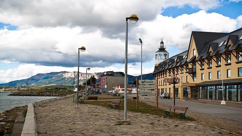
Photo: ravas51 · CC BY-SA 2.0

CountryChile
RegionPatagonia & Atacama
Best monthsNo clear best season
Nearest airportsPNT · Teniente Julio Gallardo Airport · 6 km
About
Puerto Natales is a city in Chilean Patagonia. It is the capital of both the commune of Natales and the province of Última Esperanza, one of the four provinces that make up the Magallanes and Antartica Chilena Region in the southernmost part of Chile.
Source: Wikipedia (CC BY-SA 4.0)
When to go
In Puerto Natales the warmest month is January (average high 19°) and the coolest is June (7°). Most rainy days come in January.
Highlights
From OpenStreetMap records, by distance from the centre.
- Plaza de Armas Arturo PratNature & park · 18 m
- Parroquia María AuxiliadoraSight · 108 m
- Museo Histórico MunicipalMuseum · 286 m
- Galpón Patagonia - Centro CuturalSight · 382 m
- Mirador Muelle AntiguoSight · 418 m
- Templo Iglesia de Jesucristo de los Santos de los Últimos DíasSight · 771 m
- Plaza 1° de MayoNature & park · 793 m
- Capilla San PedroSight · 886 m
- Iglesia Adventista del Séptimo DiaSight · 896 m
- Iglesia Metodista Puerto NatalesSight · 930 m
- Iglesia Evangélica PentecostalSight · 995 m
- Parque CostaneraNature & park · 1.0 km
For families with children
Parks, beaches and child-friendly places.
Average monthly temperature (°C)
| Jan | Feb | Mar | Apr | May | Jun | Jul | Aug | Sep | Oct | Nov | Dec | |
|---|---|---|---|---|---|---|---|---|---|---|---|---|
| High | 19 | 18 | 18 | 14 | 11 | 7 | 8 | 9 | 12 | 14 | 16 | 17 |
| Low | 4 | 4 | 3 | 0 | -3 | -4 | -4 | -3 | 0 | -2 | 2 | 4 |
| Rainy days | 16 | 13 | 15 | 13 | 12 | 12 | 12 | 12 | 12 | 13 | 15 | 16 |
Climate data: Wikipedia (CC BY-SA)