Destinations › Brazil, Argentina & Colombia › Medellín
Medellín
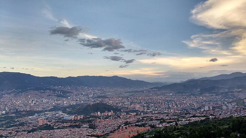
Photo: Luis90f · CC BY-SA 4.0

CountryColombia
Best monthsNo clear best season
Nearest airportsEOH · Enrique Olaya Herrera Airport · 1 km
MDE · José María Córdova International Airport · 20 km
UIB · El Caraño Airport · 131 km
MDE · José María Córdova International Airport · 20 km
UIB · El Caraño Airport · 131 km
About
Medellín ( MED-ay-EEN; Spanish: [meðeˈʝin] or [meðeˈʎin]), officially the Special District of Science, Technology and Innovation of Medellín, is the capital of the department of Antioquia, and the second-largest city in Colombia after Bogotá. It is located in the Aburrá Valley, a central region of the Andes Mountains, in northwestern South America.
Source: Wikipedia (CC BY-SA 4.0)
When to go
In Medellín the warmest month is August (average high 29°) and the coolest is November (27°). Most rainy days come in October.
Highlights
From OpenStreetMap records, by distance from the centre.
- Iglesia CristianaSight · 243 m
- zona verdeNature & park · 277 m
- Pista BicicletasNature & park · 299 m
- Arenero Playa TikiNature & park · 319 m
- Parque de la 72ANature & park · 337 m
- Iglesia de Jesucristo de Los Santos de Los Últimos Días BelénSight · 394 m
- Parroquia Jesús de la Buena EsperanzaSight · 435 m
- Parque de BelénNature & park · 700 m
- BelénNature & park · 703 m
- Iglesia Renaciendo en CristoSight · 721 m
- Parque MalibúNature & park · 735 m
- Iglesia Pentecostal Unida de Colombia - TrinidadSight · 737 m
For families with children
Parks, beaches and child-friendly places.
Average monthly temperature (°C)
| Jan | Feb | Mar | Apr | May | Jun | Jul | Aug | Sep | Oct | Nov | Dec | |
|---|---|---|---|---|---|---|---|---|---|---|---|---|
| High | 28 | 28 | 28 | 28 | 28 | 28 | 29 | 29 | 28 | 27 | 27 | 27 |
| Low | 18 | 18 | 18 | 18 | 18 | 18 | 18 | 18 | 18 | 17 | 18 | 18 |
| Rainy days | 8 | 9 | 14 | 18 | 19 | 14 | 14 | 14 | 16 | 20 | 17 | 11 |
Climate data: Wikipedia (CC BY-SA)