Destinations › Vietnam › Da Nang
Da Nang
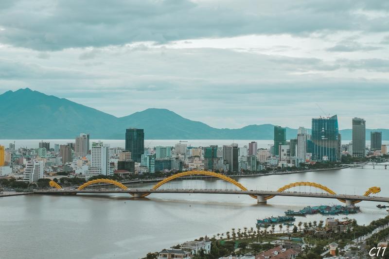
Photo: Cuong Tran · Public domain

CountryVietnam
RegionVietnam
Best monthsFeb–Apr
Nearest airportsDAD · Da Nang International Airport · 3 km
HUI · Phu Bai International Airport · 65 km
HUI · Phu Bai International Airport · 65 km
About
Da Nang, is the fourth largest city in Vietnam by population and the second largest by geographical area and located in the South Central Coast and Central Highlands. As one of the country's nine centrally-governed city, it falls under the administration of the central government.
Source: Wikipedia (CC BY-SA 4.0)
When to go
In Da Nang the warmest month is June (average high 34°) and the coolest is January (25°). Most rainy days come in November. Best months to visit: Feb–Apr.
Highlights
From OpenStreetMap records, by distance from the centre.
- Tịnh xá Ngọc GiángSight · 353 m
- Nhà thờ Tin LànhSight · 388 m
- Chợ CồnSight · 533 m
- Chùa Thuận ThànhSight · 563 m
- Nhà thờ Tin lành Tân AnSight · 794 m
- Trung Hung Buu TôaSight · 834 m
- Thánh thất Cao ĐàiSight · 835 m
- Bảo tàng Mỹ thuật Đà NẵngMuseum · 877 m
- Nhà thờ Thanh BìnhSight · 889 m
- Chùa Pháp LâmSight · 1.0 km
- Công viên Thanh BìnhNature & park · 1.1 km
- Nhà hát Trưng VươngSight · 1.2 km
For families with children
Parks, beaches and child-friendly places.
Average monthly temperature (°C)
| Jan | Feb | Mar | Apr | May | Jun | Jul | Aug | Sep | Oct | Nov | Dec | |
|---|---|---|---|---|---|---|---|---|---|---|---|---|
| High | 25 | 26 | 28 | 31 | 33 | 34 | 34 | 34 | 32 | 30 | 27 | 25 |
| Low | 19 | 20 | 22 | 24 | 25 | 26 | 26 | 26 | 24 | 24 | 22 | 20 |
| Rainy days | 12 | 6 | 5 | 5 | 9 | 8 | 9 | 12 | 15 | 20 | 20 | 19 |
Climate data: Wikipedia (CC BY-SA)