Destinations › Morocco › Chefchaouen
Chefchaouen
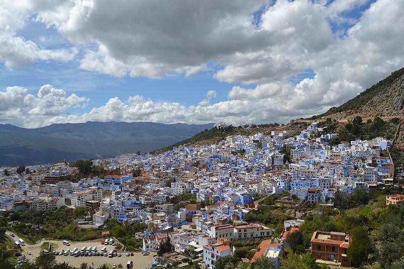
Photo: Ismailbrk · CC BY-SA 4.0

CountryMorocco
RegionMorocco
Best monthsMay–Oct
Nearest airportsTTU · Tetouan Saniat R'mel Airport · 47 km
TNG · Tangier Ibn Battouta Airport · 86 km
GIB · Gibraltar Airport · 109 km
TNG · Tangier Ibn Battouta Airport · 86 km
GIB · Gibraltar Airport · 109 km
About
Chefchaouen is a city in northwest Morocco. It is the chief town of the province of the same name and is noted for its buildings in shades of blue, for which it is nicknamed the "Blue City".
Source: Wikipedia (CC BY-SA 4.0)
When to go
In Chefchaouen the warmest month is August (average high 30°) and the coolest is January (17°). Most rainy days come in December. Best months to visit: May–Oct.
Highlights
From OpenStreetMap records, by distance from the centre.
- Masjid Al SounnaSight · 225 m
- Mosquée Hassan IISight · 638 m
- EgliseSight · 744 m
- PiazzaSight · 765 m
- Mosquée Sidi Bouker HadadSight · 777 m
- AfassiSight · 824 m
- View to the CitySight · 913 m
- Molay Ali Ben RachidSight · 990 m
- Zaouia DaekaouiaSight · 1.1 km
- Masjid Moulay Abdelrahman ChrifSight · 1.1 km
- Art Studio Omar SaadouneMuseum · 1.1 km
- Dar El OuahabiSight · 1.1 km
Average monthly temperature (°C)
| Jan | Feb | Mar | Apr | May | Jun | Jul | Aug | Sep | Oct | Nov | Dec | |
|---|---|---|---|---|---|---|---|---|---|---|---|---|
| High | 17 | 18 | 19 | 21 | 23 | 27 | 30 | 30 | 28 | 24 | 20 | 18 |
| Low | 9 | 10 | 12 | 13 | 15 | 18 | 21 | 21 | 20 | 16 | 13 | 10 |
| Rainy days | 8 | 7 | 7 | 7 | 4 | 1 | 0 | 1 | 3 | 7 | 8 | 9 |
Climate data: Wikipedia from the Ref:Tétouan station, 45 km away (CC BY-SA)