Destinations › South America › Cartagena
Cartagena
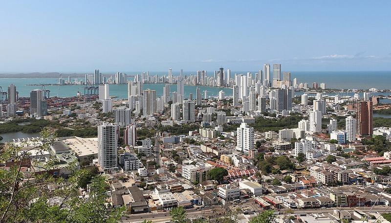
Photo: Bernard Gagnon · CC BY-SA 4.0

CountryColombia
RegionSouth America
Best monthsNo clear best season
Nearest airportsCTG · Rafael Núñez International Airport · 2 km
BAQ · Ernesto Cortissoz International Airport · 96 km
CZU · Las Brujas Airport · 124 km
BAQ · Ernesto Cortissoz International Airport · 96 km
CZU · Las Brujas Airport · 124 km
About
Cartagena, known since the imperial era as Cartagena de Indias, is a city and one of the major ports on the northern coast of Colombia in the Caribbean Coast Region, along the Caribbean Sea. Cartagena's past role as a link in the route to the West Indies provides it with important historical value for world exploration and preservation of heritage from the great commercial maritime routes.
Source: Wikipedia (CC BY-SA 4.0)
When to go
In Cartagena the warmest month is June (average high 32°) and the coolest is January (31°). Most rainy days come in October.
Highlights
From OpenStreetMap records, by distance from the centre.
- La Popa MiradorSight · 265 m
- Iglesia Hermanos en CristoSight · 943 m
- Iglesia Episcopal Nuestro SalvadorSight · 947 m
- Ministerio Rios de VidaSight · 949 m
- Iglesia La HermitaSight · 994 m
- Parque de LeonesNature & park · 1.0 km
- Casa Sobre la RocaSight · 1.1 km
- Iglesia Pentecostal Unida de ColumbiaSight · 1.2 km
- Iglesia de ToricesSight · 1.2 km
- Iglesia de Cristo el ReySight · 1.3 km
- Iglesia de Dios Ministerial de Jesucristo InternacionalSight · 1.4 km
- Templo BautistaSight · 1.4 km
Average monthly temperature (°C)
| Jan | Feb | Mar | Apr | May | Jun | Jul | Aug | Sep | Oct | Nov | Dec | |
|---|---|---|---|---|---|---|---|---|---|---|---|---|
| High | 31 | 31 | 31 | 32 | 32 | 32 | 32 | 32 | 32 | 32 | 32 | 31 |
| Low | 24 | 24 | 25 | 26 | 26 | 26 | 26 | 26 | 26 | 26 | 26 | 25 |
| Rainy days | 0 | 0 | 0 | 2 | 7 | 8 | 8 | 10 | 10 | 12 | 9 | 3 |
Climate data: Wikipedia (CC BY-SA)