Destinations › Venice & Verona › Venice
Venice
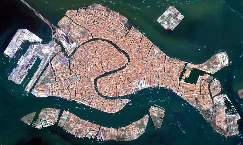
Photo: European Space Agency · CC BY-SA 3.0 igo
CountryItaly
RegionVenice & Verona
Best monthsJul–Sep
Nearest airportsVCE · Venice Marco Polo Airport · 8 km
TSF · Treviso Airport · 26 km
TRS · Trieste Airport · 98 km
TSF · Treviso Airport · 26 km
TRS · Trieste Airport · 98 km
About
Venice is a coastal city in northeastern Italy and the capital of the region of Veneto, as well as the Metropolitan City of Venice. It is built on a group of 126 islands that are separated by expanses of open water and by canals; portions of the city are linked by 472 bridges.
Source: Wikipedia (CC BY-SA 4.0)
When to go
In Venice the warmest month is July (average high 28°) and the coolest is January (8°). Most rainy days come in June. Best months to visit: Jul–Sep.
Highlights
From OpenStreetMap records, by distance from the centre.
- Palazzo BemboMuseum · 57 m
- Barbacn de ParagonSight · 103 m
- Teatro stabile del Veneto Carlo GoldoniSight · 106 m
- TIM Future CenterMuseum · 129 m
- Marci MissiaiaMuseum · 218 m
- Scala Contarini del BovoloSight · 265 m
- Casa di Marco PoloSight · 340 m
- Stele del PaneSight · 351 m
- Terrasse von Commissario BrunettiSight · 388 m
- Teatro La FeniceSight · 391 m
- Negozio OlivettiMuseum · 409 m
- S. Polo 2102 Art GalleryMuseum · 424 m
Average monthly temperature (°C)
| Jan | Feb | Mar | Apr | May | Jun | Jul | Aug | Sep | Oct | Nov | Dec | |
|---|---|---|---|---|---|---|---|---|---|---|---|---|
| High | 8 | 9 | 13 | 17 | 22 | 26 | 28 | 28 | 24 | 18 | 13 | 8 |
| Low | 0 | 1 | 4 | 9 | 14 | 17 | 19 | 19 | 15 | 10 | 6 | 1 |
| Rainy days | 6 | 5 | 6 | 8 | 8 | 9 | 6 | 6 | 6 | 7 | 6 | 6 |
Climate data: Wikipedia (CC BY-SA)