Destinations › Makkah & Madinah › Ta'if
Ta'if
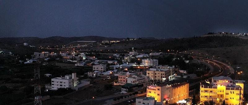
Photo: عباد ديرانية · CC BY-SA 3.0

CountrySaudi Arabia
RegionMakkah & Madinah
Best monthsJan–Apr, Nov–Dec
Nearest airportsTIF · Taif International Airport · 27 km
JED · King Abdulaziz International Airport · 138 km
JED · King Abdulaziz International Airport · 138 km
About
Taif (Arabic: اَلطَّائِفُ, romanized: Aṭ-Ṭāʾif, lit. 'The circulated or encircled', Hejazi Arabic pronunciation: [atˤˈ tˤaːɪf]) is a city and governorate in Mecca Province in Saudi Arabia. Located at an elevation of 1,879 m in the slopes of the Hijaz Mountains, which themselves are part of the Sarat Mountains, the city has a population of 563,282 people in 2022, making it one of the most populous cities in the kingdo
Source: Wikipedia (CC BY-SA 4.0)
When to go
In Ta'if the warmest month is June (average high 36°) and the coolest is January (23°). Most rainy days come in May. Best months to visit: Jan–Apr, Nov–Dec.
Highlights
From OpenStreetMap records, by distance from the centre.
Average monthly temperature (°C)
| Jan | Feb | Mar | Apr | May | Jun | Jul | Aug | Sep | Oct | Nov | Dec | |
|---|---|---|---|---|---|---|---|---|---|---|---|---|
| High | 23 | 25 | 28 | 31 | 34 | 36 | 36 | 36 | 35 | 31 | 27 | 24 |
| Low | 9 | 10 | 13 | 16 | 19 | 23 | 24 | 24 | 21 | 16 | 12 | 10 |
| Rainy days | 1 | 0 | 1 | 4 | 4 | 0 | 1 | 2 | 1 | 2 | 2 | 1 |
Climate data: Wikipedia (CC BY-SA)