Destinations › Antalya region › Kemer
Kemer
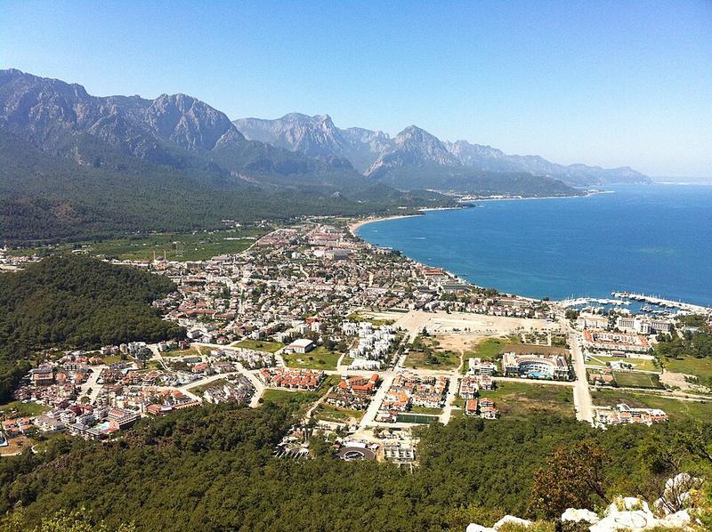
Photo: Emin Başar ÖZDEMİR · CC BY 3.0
.jpg)
CountryTurkey
RegionAntalya region
Best monthsMay, Oct
Nearest airportsAYT · Antalya Airport · 39 km
ISE · Süleyman Demirel International Airport · 141 km
ISE · Süleyman Demirel International Airport · 141 km
About
Kemer is a seaside resort, municipality and district of Antalya Province, Turkey. Its area is 412 km2, and its population is 49,383.
Source: Wikipedia (CC BY-SA 4.0)
When to go
In Kemer the warmest month is August (average high 36°) and the coolest is January (14°). Most rainy days come in December. Best months to visit: May, Oct.
Highlights
From OpenStreetMap records, by distance from the centre.
- Şehit Çavuş Selçuk GürdalNature & park · 170 m
- Osman ÜnlüNature & park · 223 m
- Kemer Belediye Kültür EviMuseum · 249 m
- Kemer Merkez CamiiSight · 330 m
- El sanatlarıSight · 349 m
- Rich Karaoke BarSight · 378 m
- kemer pansiyonSight · 427 m
- OlbiaNature & park · 437 m
- Kemer VillaSight · 459 m
- Halk plajıNature & park · 498 m
- Kuğulu ParkNature & park · 550 m
- MoonNature & park · 557 m
For families with children
Parks, beaches and child-friendly places.
Average monthly temperature (°C)
| Jan | Feb | Mar | Apr | May | Jun | Jul | Aug | Sep | Oct | Nov | Dec | |
|---|---|---|---|---|---|---|---|---|---|---|---|---|
| High | 14 | 15 | 19 | 23 | 28 | 33 | 35 | 36 | 34 | 28 | 22 | 16 |
| Low | 5 | 6 | 8 | 12 | 15 | 19 | 22 | 22 | 19 | 15 | 11 | 6 |
| Rainy days | 11 | 10 | 9 | 8 | 6 | 3 | 1 | 1 | 2 | 6 | 8 | 12 |
Climate data: Wikipedia (CC BY-SA)
Other places in the region
- AntalyaTurkey
- Lara
- Konyaaltı BeachTurkey
- KunduTurkey
- BelekTurkey
- BoğazkentTurkey
- SerikTurkey
- SideTurkey
- KumköyTurkey
- ManavgatTurkey
- KızılağaçTurkey
- OkurcalarTurkey
- AvsallarTurkey
- İncekumTurkey
- AlanyaTurkey
- MahmutlarTurkey
- KonaklıTurkey
- GazipaşaTurkey
- BeldibiTurkey
- GöynükTurkey
- ÇamyuvaTurkey
- TekirovaTurkey
- ÇıralıTurkey
- AdrasanTurkey
- KumlucaTurkey
- FinikeTurkey
- DemreTurkey
- KaşTurkey
- KalkanTurkey