Destinations › Jeju, Taiwan & Gyeongju › Gyeongju
Gyeongju
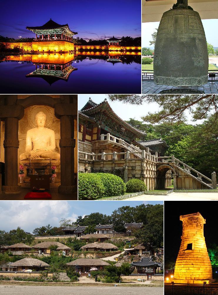
Photo: Kyoww (montage) · CC BY-SA 4.0

CountrySouth Korea
RegionJeju, Taiwan & Gyeongju
Best monthsOct
Nearest airportsKPO · Pohang Airport (G-815/K-3) · 23 km
TAE · Daegu International Airport · 51 km
PUS · Gimhae International Airport · 80 km
TAE · Daegu International Airport · 51 km
PUS · Gimhae International Airport · 80 km
About
Gyeongju, historically known as Sŏrabŏl, is a coastal city in the far southeastern corner of North Gyeongsang Province, South Korea. It is the second largest city by area in the province after Andong, covering 1,324 km2 with a population of 264,091 people as of December 2012.
Source: Wikipedia (CC BY-SA 4.0)
When to go
In Gyeongju the warmest month is August (average high 30°) and the coolest is January (8°). Most rainy days come in July. Best months to visit: Oct.
Highlights
From OpenStreetMap records, by distance from the centre.
For families with children
Parks, beaches and child-friendly places.
Average monthly temperature (°C)
| Jan | Feb | Mar | Apr | May | Jun | Jul | Aug | Sep | Oct | Nov | Dec | |
|---|---|---|---|---|---|---|---|---|---|---|---|---|
| High | 8 | 10 | 14 | 18 | 22 | 25 | 28 | 30 | 26 | 22 | 17 | 10 |
| Low | 0 | 2 | 5 | 10 | 15 | 18 | 22 | 24 | 20 | 14 | 8 | 2 |
| Rainy days | 5 | 6 | 8 | 9 | 9 | 10 | 14 | 12 | 9 | 5 | 6 | 5 |
Climate data: Wikipedia from the Busan station, 76 km away (CC BY-SA)