Destinations › More of Australia › Byron Bay
Byron Bay
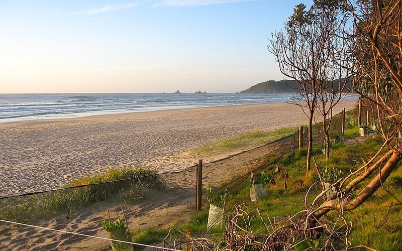
Photo: Unknown authorUnknown author · Public domain

CountryAustralia
RegionMore of Australia
Best monthsJul–Oct
Nearest airportsBNK · Ballina Byron Gateway Airport · 21 km
OOL · Gold Coast Airport · 55 km
BNE · Brisbane Airport · 149 km
OOL · Gold Coast Airport · 55 km
BNE · Brisbane Airport · 149 km
About
Byron Bay is a beachside town located in the far-northeastern corner of New South Wales, Australia. It is located 772 kilometres north of Sydney and 165 kilometres south of Brisbane.
Source: Wikipedia (CC BY-SA 4.0)
When to go
In Byron Bay the warmest month is January (average high 29°) and the coolest is July (21°). Most rainy days come in December. Best months to visit: Jul–Oct.
Highlights
From OpenStreetMap records, by distance from the centre.
- St Finbarr's Catholic ChurchSight · 289 m
- John Knox Presbyterian ChurchSight · 345 m
- Paterson Street Hilltop ReserveNature & park · 459 m
- Eric Wright LookoutSight · 469 m
- Jarjumirr ParkNature & park · 503 m
- Lone Goat GalleryMuseum · 597 m
- Clarkes Beach ParkNature & park · 656 m
- Tag Byron BaySight · 717 m
- Railway ParkNature & park · 730 m
- Dening ParkNature & park · 754 m
- RetrospectMuseum · 780 m
- McKellar Court ParkNature & park · 862 m
For families with children
Parks, beaches and child-friendly places.
Average monthly temperature (°C)
| Jan | Feb | Mar | Apr | May | Jun | Jul | Aug | Sep | Oct | Nov | Dec | |
|---|---|---|---|---|---|---|---|---|---|---|---|---|
| High | 29 | 29 | 28 | 26 | 24 | 21 | 21 | 22 | 24 | 25 | 27 | 28 |
| Low | 22 | 22 | 21 | 18 | 15 | 13 | 12 | 12 | 15 | 17 | 19 | 20 |
| Rainy days | 9 | 8 | 9 | 9 | 8 | 7 | 7 | 6 | 5 | 6 | 8 | 9 |
Climate data: Wikipedia from the Gold-Coast station, 75 km away (CC BY-SA)