Destinations › India › Agra
Agra
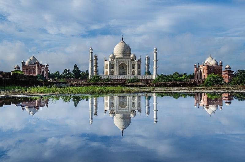
Photo: Antrix3 · CC BY-SA 4.0

CountryIndia
RegionIndia
Best monthsJan–Feb, Nov–Dec
Nearest airportsAGR · Agra Civil Enclave · 5 km
GWL · Gwalior Airport · 100 km
DXN · Noida International Airport · 118 km
GWL · Gwalior Airport · 100 km
DXN · Noida International Airport · 118 km
About
Agra is a city on the banks of the Yamuna river in the Indian state of Uttar Pradesh. It is a part of Western Uttar Pradesh, about 230 kilometres south-east of the national capital Delhi and 330 km west of the state capital Lucknow.
Source: Wikipedia (CC BY-SA 4.0)
When to go
In Agra the warmest month is May (average high 42°) and the coolest is January (22°). Most rainy days come in July. Best months to visit: Jan–Feb, Nov–Dec.
Highlights
From OpenStreetMap records, by distance from the centre.
- Hanuman MandirSight · 121 m
- Purani MasjidSight · 242 m
- Central Methodist ChurchSight · 431 m
- Maa Chamunda MandirSight · 792 m
- Subhash ParkNature & park · 903 m
- Ambedkar ParkNature & park · 929 m
- Saraswati Shishu MandirSight · 967 m
- Jama MasjidSight · 980 m
- Hanuman TempleSight · 1000 m
- MosqueSight · 1.0 km
- Hathi PolSight · 1.0 km
- Police Line FieldNature & park · 1.2 km
For families with children
Parks, beaches and child-friendly places.
- Subhash ParkNature & park · 903 m
- Ambedkar ParkNature & park · 929 m
- Police Line FieldNature & park · 1.2 km
- Police Line ground;Pared groundNature & park · 1.3 km
- Saraswati GardenNature & park · 1.3 km
- Kalpna Chavla UdhanNature & park · 1.3 km
- Dr. Sarvepalli Radhakrishnan GardenNature & park · 1.4 km
- Dhup Ghdi UdhanNature & park · 1.5 km
Average monthly temperature (°C)
| Jan | Feb | Mar | Apr | May | Jun | Jul | Aug | Sep | Oct | Nov | Dec | |
|---|---|---|---|---|---|---|---|---|---|---|---|---|
| High | 22 | 26 | 32 | 38 | 42 | 41 | 36 | 33 | 34 | 35 | 29 | 24 |
| Low | 7 | 10 | 14 | 20 | 24 | 26 | 25 | 24 | 24 | 19 | 13 | 8 |
| Rainy days | 1 | 1 | 1 | 1 | 2 | 3 | 10 | 10 | 6 | 1 | 0 | 0 |
Climate data: Wikipedia (CC BY-SA)